Abstract
Enterprise entry into Bangalore is commonly framed as a hiring problem solved through proximity to established talent density along the Outer Ring Road or within the Whitefield ITPL region. That framing supports speed, but it rarely survives a decade of operational growth. The more durable question is spatial. Can the chosen territory support continuous operations, controlled expansion, and infrastructure certainty across a twenty-year horizon.
The evidence suggests that Bangalore has evolved from a single employment basin into a set of economic corridors, each defined by distinct constraints in power availability, water security, commute geometry, land availability, and regulatory posture. The central tradeoff is no longer rent versus location. It is density versus expandability and leased flexibility versus operational sovereignty.
For high integrity capital, the preferred path increasingly runs through statutory industrial land frameworks rather than private land conversion, particularly where Karnataka Industrial Areas Development Board allotment provides defined zoning, infrastructure planning, and a cleaner legal substrate. A resilient entry strategy therefore begins with a territorial decision. It treats land, utilities, and mobility as a single system and moves from transactional space selection toward campus logic where physical control supports operational continuity and long horizon cost stability.
Foundational Context
Bangalore’s enterprise geography has unfolded through several distinct phases, each shaped by a different constraint set.
The early multinational footprint of the 1990s favored central business districts because the primary objective was presence. Offices were distributed across the historic city core, particularly around MG Road, Residency Road, and Lavelle Road. These facilities operated within conventional commercial premises and assumed limited headcount with minimal infrastructure requirements.
The first major spatial shift occurred with the development of technology parks during the late 1990s and early 2000s. Whitefield and the International Tech Park Bangalore introduced a new spatial model. Technology parks offered large floor plates, integrated services, and a landlord managed operational envelope. Enterprises could deploy quickly without navigating land acquisition or construction timelines.
The second phase consolidated along the Outer Ring Road corridor. Commercial parks emerged between Marathahalli, Bellandur, and Sarjapur Road, forming a continuous employment spine. The corridor gradually became the gravitational center of Bangalore’s technology labor market. Employees relocated around it, residential development expanded in East Bangalore, and hiring pipelines began to assume proximity to this corridor.
Over the past decade this model began to encounter structural limits. Travel time variability along the Outer Ring Road increased year after year. Land values rose sharply and contiguous parcels became rare. Expansion frequently required leasing additional buildings rather than extending an integrated campus.
At the same time Bangalore’s industrial base broadened. Aerospace, advanced manufacturing, hardware engineering, and research and development functions expanded alongside traditional software operations. These activities require larger land parcels, secure perimeters, specialized facilities, and infrastructure capacities that are difficult to deliver inside dense commercial corridors.
State policy responded through industrial land aggregation. The Karnataka Industrial Areas Development Board expanded its role as an allocator of industrial land under the KIADB Act of 1966. Industrial estates were planned with defined zoning, infrastructure provision, and coordinated development.
North Bangalore began emerging as a corridor where these forces converge. The Devanahalli Aerospace Park anchored an industrial geography aligned with the international airport. The proposed Satellite Town Ring Road introduced a regional transportation spine linking industrial and logistics zones beyond the congested core.
The Tumakuru Road corridor, including Dabaspete, developed as a manufacturing and logistics belt with parcel sizes that the urban core can no longer support. Bangalore therefore presents not one enterprise geography but a network of territories, each governed by its own operational logic.
The Spatial Architecture of Enterprise Entry
Enterprise location in Bangalore is governed by the interaction of three structural systems.
The first system is labor geography. Talent pools cluster around employment corridors and residential zones connected by major transport routes. Over time these clusters create self reinforcing hiring ecosystems.
The second system is infrastructure reliability. Power redundancy, water security, digital connectivity, and transport networks determine whether operations can scale without interruption.
The third system is land governance. Zoning frameworks, land acquisition pathways, and regulatory oversight determine whether enterprises can secure land parcels that support long horizon expansion.
Enterprise entry becomes durable only when these systems align. A corridor may offer strong talent density but limited infrastructure capacity. Another corridor may offer abundant land and utilities but a thinner labor market during early phases of development.
The practical task of spatial strategy is therefore to locate the territory where these systems converge in a stable configuration.
The Territorial Structure of Bangalore’s Enterprise Corridors
The modern enterprise geography of Bangalore can be understood through several major corridors.
The Outer Ring Road corridor remains the most concentrated technology employment belt in the city. It offers immediate access to established hiring networks and mature commercial infrastructure. The constraint is saturation. Travel times are volatile, and expansion through contiguous land acquisition is rarely possible.
Whitefield and the ITPL region represent the earliest generation of technology park development. While the ecosystem remains mature, available land parcels are limited and much of the infrastructure operates within landlord controlled environments.
North Bangalore, particularly the Devanahalli corridor, has emerged as the primary zone for new enterprise campuses. The presence of Kempegowda International Airport provides global connectivity. Large land parcels remain available and industrial estates such as the Aerospace Park support specialized manufacturing and research operations.
The Tumakuru Road and Dabaspete corridor functions as a logistics and manufacturing belt connected to the national highway network. Parcel sizes remain larger and development intensity is lower, supporting operations that require horizontal planning.
The Sarjapur corridor continues to support technology employment but faces infrastructure constraints similar to those of the Outer Ring Road. Commute variability and limited land availability create long term expansion challenges.
Each corridor therefore represents a different balance between labor proximity, infrastructure reliability, and land availability.
Technical Framework
Enterprise site selection requires analysis of three technical systems: land framework, utility infrastructure, and campus development geometry.
Land framework and regulatory certainty
Industrial land acquired through KIADB differs fundamentally from privately assembled land parcels. Under the KIADB Act of 1966 the board acquires land, develops industrial estates, and allocates parcels to enterprises within designated zones.
The advantage of this framework is procedural clarity. Land arrives with predefined zoning intent, integrated infrastructure planning, and a lower probability of hidden title discontinuity compared to private agricultural land.
Private land acquisition often requires conversion under Section 95 of the Karnataka Land Revenue Act. Conversion introduces layered approvals and may attract objections if historical title chains are contested. For enterprises requiring speed and legal certainty, KIADB allotment frequently provides a more stable entry channel.
Power infrastructure and operational uptime
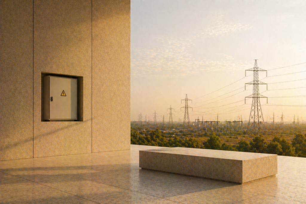
Reliable power supply requires more than a grid connection. Enterprises must evaluate substation capacity, feeder availability, and commissioning timelines through BESCOM protocols.
A technical audit typically examines the distance to the nearest 66/11 kV or higher capacity substation, the feasibility of dedicated feeders, and the timeline required for commissioning redundant supply lines.
Operations involving research laboratories, data centers, or precision manufacturing often require N plus one redundancy or looped supply configurations to maintain uninterrupted uptime.
Water security and wastewater management
Water resilience has become a defining operational constraint in Bangalore. BWSSB coverage remains uneven across emerging corridors. Many campuses therefore rely on a combination of borewells, rainwater harvesting, treated water reuse, and tanker supply.
Campuses exceeding specified thresholds of built area require sewage treatment plants. Treated wastewater becomes a resource for cooling towers, landscape irrigation, and flushing systems.
Enterprises that fail to integrate water reuse infrastructure frequently encounter escalating operating costs during seasonal shortages.
FAR and campus geometry
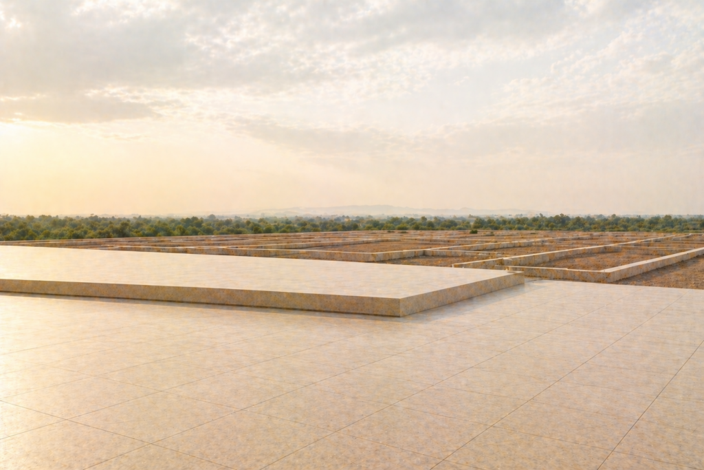
Floor Area Ratio regulations influence the spatial form of the campus. Vertical development may increase density but can complicate logistics, security zoning, and team adjacency. Horizontal planning allows operational continuity across departments but requires larger land parcels.
The FAR decision therefore reflects organizational structure as much as regulatory allowance.
Strategic Interpretation
Enterprise entry decisions in Bangalore increasingly resemble spatial arbitrage. The city offers two categories of advantage but rarely in the same territory.
The Outer Ring Road and Whitefield corridors provide immediate hiring capability and established vendor ecosystems. The cost is spatial rigidity. Expansion becomes fragmented and commute variability increases operational friction.
North Bangalore and emerging industrial corridors offer territorial elasticity. Large parcels support campus master planning, dedicated infrastructure, and phased expansion. The cost is early stage ecosystem maturity and initial commute adjustments for portions of the workforce.
This tradeoff is temporal rather than geographic. Established corridors optimize immediate capability while emerging corridors optimize long horizon expansion.
Enterprises expecting sustained growth frequently reach the limits of leased multi tenant clusters within a few years. Fragmented expansion introduces operational inefficiencies and repeated relocation costs.
The move toward campus sovereignty therefore reflects structural necessity rather than corporate preference.
Operational sovereignty has three dimensions.
Control over perimeter security\Control over infrastructure and utilities
Control over expansion planning
Where enterprises control the campus envelope, infrastructure systems can be engineered rather than negotiated.
The Risk Ledger
Enterprise entry strategies frequently fail for reasons that do not appear in leasing brochures or macroeconomic dashboards.
Water supply volatility remains a major operational risk. Corridors dependent on tanker supply experience sharp price fluctuations during seasonal shortages. Campuses without integrated water reuse infrastructure inherit recurring operational instability.
Commute geometry can also destabilize operations. Travel time patterns shift as employment density increases. Corridors that appear accessible at the time of entry may experience rapid congestion within a few years.
Private land conversion introduces regulatory latency. Conversion approvals under land revenue frameworks can be delayed by historical title objections or litigation. Even minor disputes can suspend development timelines.
Utility commissioning delays also present operational risk. Power feeders, substations, and water connections frequently lag behind construction completion.
Each of these factors originates from infrastructure and governance dynamics rather than macroeconomic demand.
Strategic Judgment
A resilient enterprise entry strategy therefore begins with corridor selection rather than building selection.
For large scale operations requiring security, specialized infrastructure, or long horizon expansion, statutory industrial land frameworks offer a cleaner operational foundation. KIADB allotment reduces the burden of land assembly and provides clearer zoning intent.
North Bangalore, particularly the Devanahalli corridor and the Aerospace Park region, aligns with this model. Proximity to the international airport supports global mobility while emerging infrastructure corridors such as the Satellite Town Ring Road strengthen long term connectivity.
Established corridors such as the Outer Ring Road continue to support rapid entry through leased environments. The disciplined strategy separates the entry horizon from the expansion horizon.
Initial operations may deploy in leased clusters to accelerate hiring. Long term operations anchor on a campus that supports infrastructure sovereignty and territorial elasticity.
Over time enterprises that control their physical environment achieve more stable operating costs and greater flexibility in scaling.
The Knowledge Structure of Enterprise Geography
The spatial strategy described here forms part of a broader examination of enterprise real estate systems within the STALAH Journal.
Supporting analyses examine topics such as:
- Why Global Capability Centers Choose Bangalore
- The Geography of GCC Clusters
- The Infrastructure Logic Behind Enterprise Campuses
- How Multinationals Evaluate Real Estate Markets
- The Talent Geography of Bangalore
- Inside the KIADB Land Allocation Process
- Industrial Land versus Commercial Land Economics
- Power Redundancy in Enterprise Real Estate
- Data Centers and the Geography of Electricity
- The Devanahalli Aerospace Corridor
- Each of these studies expands on the structural systems introduced in this paper.
Closing Reflection
Bangalore remains one of the world’s most significant enterprise operating environments, but it is no longer a single geography. It is a network of corridors shaped by different combinations of labor density, infrastructure reliability, and land availability.
Entering the city therefore requires more than selecting a building. It requires identifying the territory from which an enterprise can operate and expand over decades.
The office floor that solved entry speed during earlier growth cycles increasingly proves insufficient for the next phase of enterprise expansion.
A durable strategy treats real estate as part of operational risk management. Land framework, utilities, commute geometry, and development intensity must be evaluated as a single system.
Where that system remains coherent across time, enterprise presence in Bangalore moves from temporary occupancy to institutional permanence.
Related Reading
Frequently Asked Questions
Which corridor in Bangalore is best for a GCC in 2026?
The Outer Ring Road (ORR) corridor — spanning Marathahalli, Kadubeesanahalli, and Bellandur — leads Bangalore’s GCC market in 2026, accounting for approximately 38% of all GCC leasing activity. It offers the highest talent density, best metro connectivity (Purple Line directly accessible at multiple stations), Grade A tech park supply from landlords like RMZ, Embassy, and Prestige, and tech park rates of ₹120-180/sqft/month. Whitefield is the second choice, with deeper campus format inventory and slightly lower rates of ₹90-130/sqft/month. Devanahalli suits GCCs in aerospace and hardware requiring proximity to BIAL and the aerospace SEZ, but at the cost of limited talent pool depth in 2026.
How long does it typically take to set up a GCC campus in Bangalore?
A GCC setup in leased tech park space takes 12-18 months from mandate to full operations: 2-3 months for site selection and lease execution, 4-6 months for fit-out construction, and 3-6 months for ramp-up to operational headcount. An owned campus on acquired land takes 4-7 years from land acquisition to occupation — 18-36 months for regulatory approvals (DC conversion, layout, building plan sanction), 18-24 months for construction, and 6-12 months for systems commissioning and fit-out. BESCOM HT power connection (6-18 months) is routinely the critical path for owned campus timelines, making early application the single highest-value project management action.
What infrastructure risks should a multinational verify before signing a Bangalore office lease?
The four infrastructure risks requiring verification before lease signature are: power reliability (confirm BESCOM feeder classification — industrial feeders have fewer planned outages than residential; verify backup DG capacity and fuel storage for the park); water supply source and adequacy (BWSSB connection vs tanker dependency — tanker at ₹800-1,500/kl is not viable for large campuses); connectivity (dark fibre redundancy — minimum two physically separated paths from two separate providers); and access infrastructure (road widening status for the primary access corridor; BBMP or NHAI construction timelines that may disrupt daily commute during the lease term). These risks are park-specific and not reflected in the headline lease rate.
Enterprise Real Estate: Complete Reading List
- Why Global Capability Centers Choose Bangalore
- The Geography of GCC Clusters
- The Talent Geography of Bangalore
- How Multinationals Evaluate Real Estate Markets
- The Infrastructure Logic Behind Enterprise Campuses
- Industrial Land versus Commercial Land Economics
- Inside the KIADB Land Allocation Process
- Data Centers and the Geography of Electricity
- Power Redundancy in Enterprise Real Estate
- Workforce Density and Commuting Geometry
- Enterprise Security Infrastructure
- The Economics of Technology Parks
- Leasing versus Campus Ownership
- Enterprise Infrastructure Risk Audits
- Logistics Geography of Bangalore
- Manufacturing Expansion Corridors
- Aerospace and Aviation Infrastructure
- Enterprise Land Banking Strategy
- The Long Horizon Enterprise Campus
- Electricity Connections as a Compliance Gate in Bangalore
Arpitha is the founder of Stalah, a principal-led real estate house shaped by clarity, discretion, and long-term thinking. Her approach focuses on selective mandates, thoughtful representation, and measured real estate decisions.